A New Era Of
Advanced Technology &Innovation Hub
Experience a unique perspective with our comprehensive suite of surveying solutions, cutting-edge technology, and precision engineering.
Ready to experience the future of surveying technology?
Frequently AskedQuestions
Everything you need to know about our drone surveying and mining services.
What types of surveying services do you offer?
We offer comprehensive land surveying, construction surveying, topographic mapping, drone surveying, and mining lease mapping. Visit our Services page for complete details on all our offerings.
How accurate are your drone surveys?
Our drone surveys use advanced technology to achieve millimeter-level accuracy, ensuring reliable and precise results for your mining and construction projects.
How do I request a quote?
You can request a free quote by visiting our Contact page or clicking the 'Get a Free Quote' button. We'll get back to you within 24 hours with a detailed proposal.
Still have questions? We're here to help!
Trusted by IndustryLeaders
"Lensman Survey's precision drone mapping has revolutionized our mining operations. The accuracy and detail of their surveys have helped us optimize our extraction processes and ensure compliance with all regulations."
Jaichand Lal Daga
Mines Firm Director
Jaichand Lal Daga Mines
"Working with Lensman Survey has been exceptional. Their topographic mapping and 3D modeling services have been instrumental in our large-scale projects. The team's expertise is truly unmatched."
Himmat Baid
Mines Firm Partner
Shanta Sales Corporation
"The accuracy and reliability of Lensman Survey's drone services have consistently exceeded our expectations. Their detailed reports and quick turnaround times have kept our projects on schedule and within budget."
Rajesh Chura
Mines Firm Director
K.G. Mines & Minerals
"Lensman Survey's operations have been seamless and efficient. The team's expertise and attention to detail have made our projects successful."
Mohit & Rohit Daga
Mines Firm Partners
Sampat Lal Daga Mines
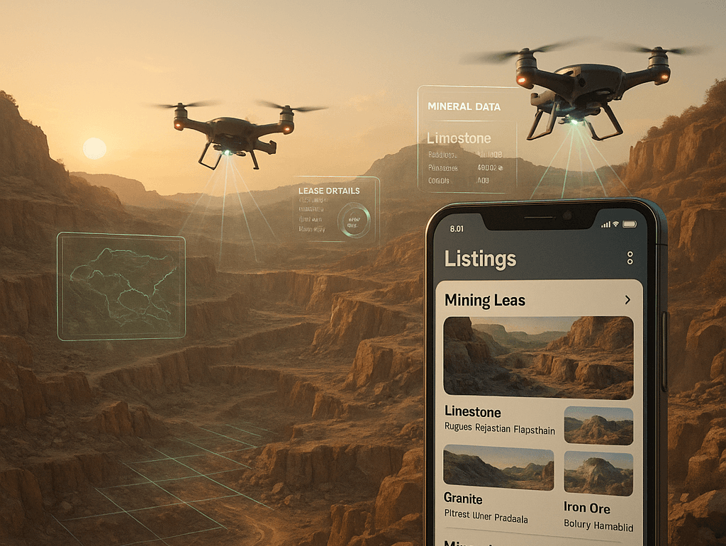
Introducing theLensman App
Our mobile-first solution to simplify mine lease listings and drone-backed insights. India's most trusted mining lease marketplace for limestone, gypsum, and clay.
Learn More